Steven Golightly woke up Monday morning and walked down his street in Beverly Crest to find a mudslide had entombed two of his neighbor’s cars.
The 71-year-old, who lives on North Beverly Drive, had spotted a social media post online about the mudslide but wanted to see it in person.
“It was a mess,” he said. “I can’t imagine waking up to that being in my home.”
Thousands of Southern Californians confronted similar scenes this week, as the monster storm that hammered Southern California triggered hundreds of mudslides across the region. The city of Los Angeles alone saw 562 mudslides and 15 homes red-tagged as of Wednesday evening, according to Mayor Karen Bass’ office.
“Our hillsides are already saturated. So even not-very-heavy rains could still lead to additional mudslides,” Bass said during a news conference. “Even when the rain stops, the ground may continue to shift.”
The main ingredients required for a mudslide are heavy storm and a steep and relatively bare slope. The risk goes up when the ground has been softened before the storm by a recent rainfall, and as Bass noted, it doesn’t end when the rain stops.
Huge mudslides were reported Wednesday between Bowmont and Skyline drives, closing down stretches of Mulholland Drive for repairs. The Los Angeles Department of Water and Power said that crews moved a power pole in the affected area to a different location on the hillside during the repairs.
A bicyclist tries to cross a mudslide on Thursday on Mulholland Drive in Studio City.
(KTLA)
Not surprisingly, the areas most prone to mudslides are those on or near hillsides, especially those charred by wildfires in recent years that have little vegetation to hold the soil in place, the California Department of Conservation says. The agency says that burnt soil and vegetation on the slopes more than doubles the rate that water runs off, raising the risk of slides.
A debris flow is a faster, more dangerous form of mudslide that can carry entire trees, rocks, cars or sandbags.
In 2018, a debris flow in Montecito, near Santa Barbara, destroyed or damaged hundreds of homes and killed 23 people.
The state Department of Conservation keeps a record of landslides across the state, and Los Angeles and Ventura counties offer online maps that highlight the areas with higher landslide risks. Ventura County’s site goes one step further, estimating that more than 52,000 structures and 152,000 county residents are at high risk of landslides.
To reduce mudslide risks, Los Angeles County officials recommend that residents get rid of dead vegetation and litter, limit the height of plants near buildings to 18 inches, inspect slopes for holes, cracks and other changes, build at a distance from steep slopes and plant vegetation that is less likely to burn — and keep it watered.
Earthquakes, weak or loose soil, steep slopes, improper construction and changes in runoff patterns can also contribute to slides. Officials recommend residents be prepared for slides up to five years after a wildfire, and to pay attention to weather forecasts and evacuate before a storm arrives if possible.

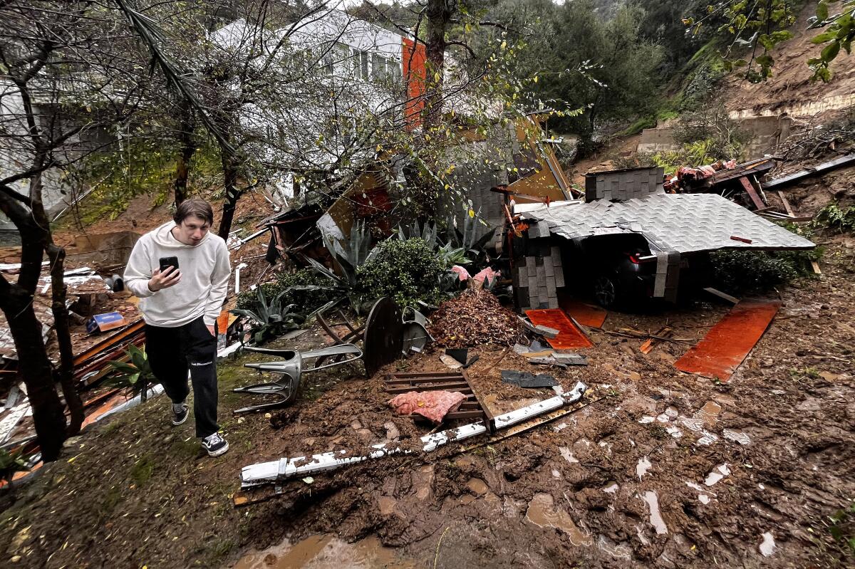
Storm chaser Tanner Charles walks by what is left of a home destroyed by a mudslide in the 10000 block of Caribou Lane in the Beverly Crest area of Los Angeles.
(Allen J. Schaben / Los Angeles Times)
Golightly, who’s been a resident of Beverly Crest for about eight years, lives on the opposite side of the street of the mudslide in Beverly Crest. The storm flooded the empty lot near his house, causing rainwater to flow through the fence and damage his first-floor guest room.
“It soaked the carpet and it’s squishy,” he said. “It’s gonna take some time to get it dried out and the carpet replaced.”
Nevertheless, Golightly said he feels lucky to have emerged from the storm relatively unscathed. His neighbors across the street, he said, had their 8-foot pool filled to the brim with mud from the nearby landslide.
“We have neighbors who’ve been here since the 1970s and they said they’ve never, ever seen anything like this,” he added.
This story originally appeared on LA Times

