


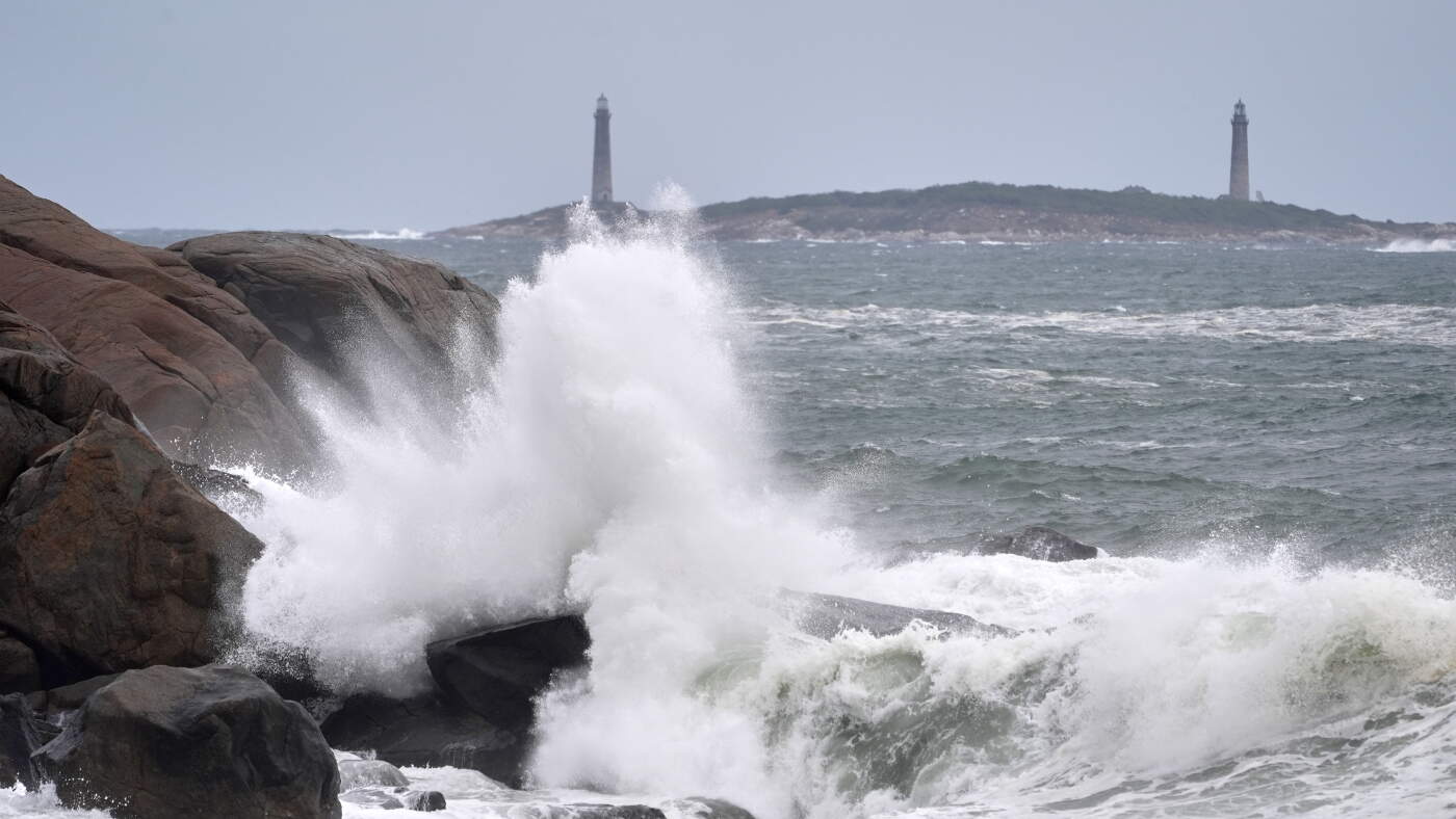
Surf breaks along the rocky coastline, with the twin lighthouses of Thatcher Island visible in the distance, during the early stages of a nor’easter Friday, Sept. 25, 2026, in Gloucester, Mass.
Robert F. Bukaty/FR172387 AP Photo
hide caption
toggle caption
Robert F. Bukaty/FR172387 AP Photo
Thousands were without power on the U.S. East Coast on Friday night as roads flooded in some coastal New Jersey communities, the first major signs of a powerful nor’easter expected to create dangerous conditions through the weekend.
Tens of millions of people are in the path of the storm already beginning to lash the region with strong winds and rain as it braces for much more. Dangerous flooding is expected along the Mid-Atlantic coast, particularly near New Jersey and Delaware, according to the National Weather Service.
In the coastal New Jersey borough of Surf City, water, with waves rippling along its surface, flooded the streets, inundating some homes. About 34 miles (54.7 kilometers) up the coast in the borough of Manasquan, where some roads were also flooding, Mayor Mike Mangan said he expected “a lot of water in the streets for a long time.” A voluntary evacuation had been issued earlier in some low-lying areas of the community.
Concerts were canceled, along with dozens of flights going into airports in Boston, Nantucket and Martha’s Vineyard on Friday and Saturday. Several airlines were offering to waive some change or cancellation fees for some East Coast flights through the weekend.
New Jersey communities prepare for major flooding
Brian Kelly, the mayor of the tiny New Jersey beach community Sea Bright, said the borough is bracing for winds up to 50 mph (80 kph) and flooding that could reach up to 6 feet (1.8 meters) on some streets. Officials expect the flooding to start Saturday and worsen by midday.
“It’s going to be worse than average. We do have probably one or two flooding events a year, sometimes more, sometimes less, but I think this one will be closer to an Irene-scale flooding event,” Kelly said, referencing the 2011 storm that caused major flooding in the Northeast. “I hope I’m wrong, but that’s my gut feeling.”
Kelly hopes hundreds of residents living in low-lying areas will consider evacuating. He said the town will open its recreation center for evacuees.
Damaging winds threaten coastal New England
Peak wind gusts could approach 60 to 65 mph (97 to 105 kph) on Cape Cod, Martha’s Vineyard and Nantucket on Friday night and Saturday, compared with about 50 to 55 mph (80 to 89 kph) around Boston and 35 to 40 mph (56 to 64 kph) farther inland, according to Matthew Belk, a meteorologist with NWS in Norton, Massachusetts.
“It’s definitely going to be a case of the closer to the coast you are, the more impacts from the storm you’re likely to see,” Belk said.
Belk said nor’easters are not unusual as New England moves into fall, but one concern this early in the season is that leaves remain on the trees, creating more wind resistance. That could increase the risk of downed limbs, which in turn can cause power outages and leave debris in roads, he said.
Along the Atlantic coasts of New Jersey and Delaware, wind gusts could reach 60 mph (96.6 kph), according to NWS. In southeastern Connecticut and eastern Long Island, New York, gusts could get almost as high, potentially downing tree limbs and power lines.
Storm disrupts concerts, baseball and flights
More than 200 flights to and from airports in Boston, Nantucket, Martha’s Vineyard and New York had been canceled Friday, and more cancellations were already in place for Saturday.
Meanwhile, the Red Sox announced their weekend series against the Chicago Cubs would be adjusted. The team moved the Sunday afternoon game to Friday to create a split doubleheader. Separately, Ed Sheeran announced that his high-profile Friday and Saturday shows at Gillette Stadium in Foxborough, Massachusetts, would be canceled due to the storm.
The public ferry service connecting Cape Cod with the islands of Nantucket and Martha’s Vineyard was experiencing widespread cancellations Friday due to strong winds and choppy water.
In Rhode Island, ferries were also canceled for Block Island. The disrupted ferry service was expected to also spill into Saturday.
For people who regularly travel to and from the islands, the possibility of getting stuck on one side or the other is “part of life,” said Sean Driscoll, a spokesperson for the Woods Hole, Martha’s Vineyard and Nantucket Steamship Authority. Most people have backup plans in place for when boats are canceled.
“It’s a nuisance, but you know, we know what to do with this kind of stuff at this point,” he said. “This is not out of the realm of ordinary.”
Ashley Destino of Gloucester, a coastal city in northern Massachusetts, enjoyed a stroll along the beach with her two young children before preparing to hunker down at home during the storm.
“We came to the beach on Friday afternoon because we knew we were going to be inside all weekend,” said Destino, who has Legos and arts and crafts activities prepared to entertain her two children, ages 7 and 4.
She also prepared by securing her boat with additional lines, and her husband pulled out a generator in case the electricity goes out.
This story originally appeared on NPR

